

Khatyrka (river)
| Khatyrka | |
|---|---|
| Location | |
| Country | Russia |
| Federal subject | Chukotka Autonomous Okrug |
| District | Anadyr District |
| Physical characteristics | |
| Source | |
| • location | Koryak Highlands |
| • coordinates | 62°18′03″N 171°29′06″E / 62.30083°N 171.48500°E |
| • elevation | ca 600 metres (2,000 ft) |
| Mouth | Bering Sea |
• coordinates | 62°02′35″N 175°16′40″E / 62.04306°N 175.27778°E |
• elevation | 0 metres (0 ft) |
| Length | 367 km (228 mi) |
Basin size | 13,400 km2 (5,200 sq mi) |
| Discharge | |
| • average | 174 m3/s (6,100 cu ft/s) |
The Khatyrka (/xəˈtɪərkə/; Russian: Хатырка, IPA: [xɐˈtɨrkə]; Chukchi: Ватыркан, romanized: Watyrkan) is a river in Chukotka Autonomous Okrug, Russia. The length of the river is 367 kilometres (228 mi) and the area of its drainage basin is 13,400 square kilometres (5,200 mi2).[1]
The name of the river comes from the Chukot watyrkan (ватыркан), meaning 'a dry, depleted place'.[2]
Course
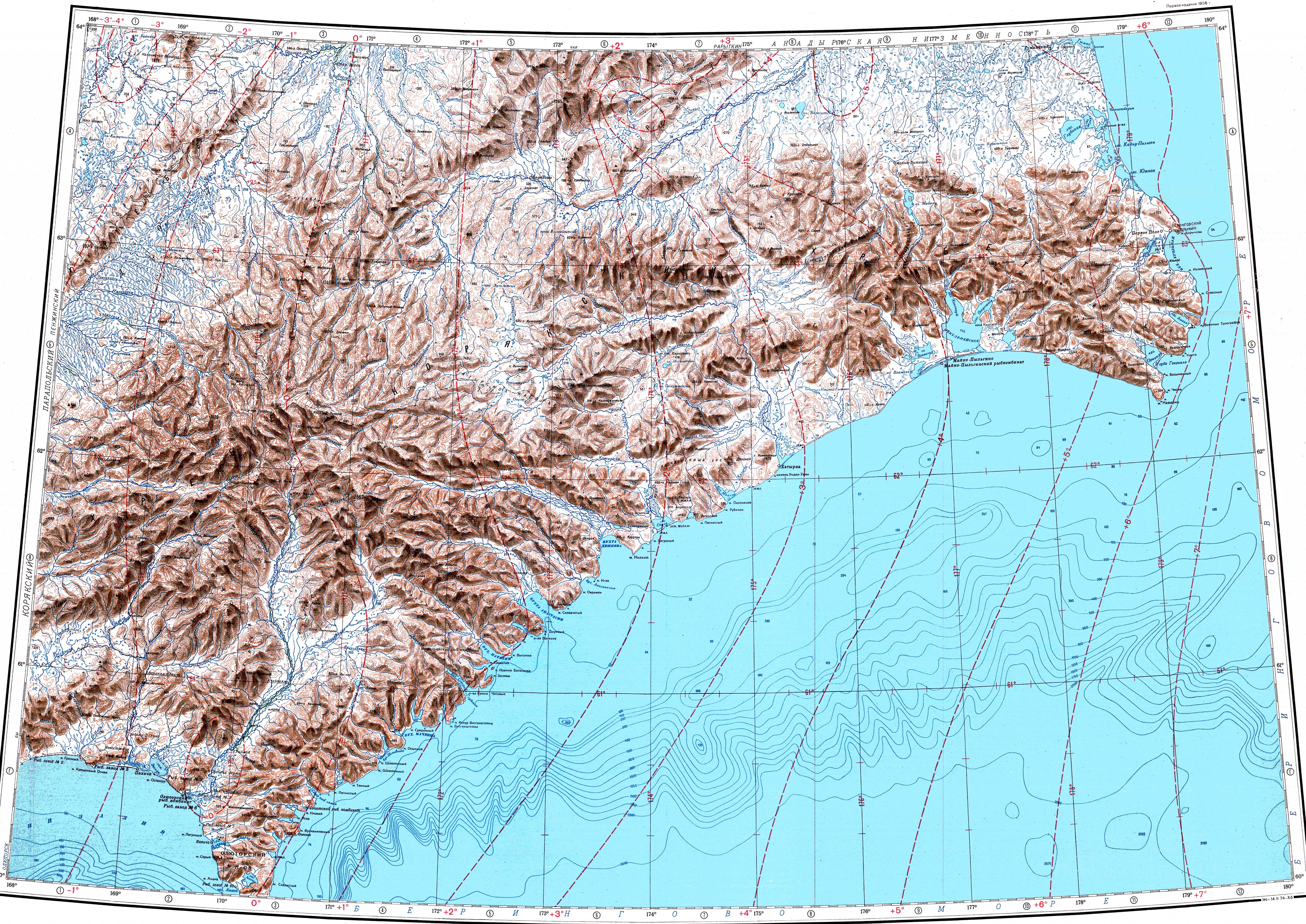
The Khatyrka has its source in the Koryak Highlands. It first flows in an ENE direction along the northern slopes of the Komeutyuyam Range as a mountain river within a narrow valley. It bends to the SSE at the northeastern end of the range and the valley expands, the river dividing into channels. In its lower course it flows along a marshy floodplain.[3][4] A stretch of the river forms the border with the Olyutorsky District of Kamchatka Krai. Its mouth is in an estuary that is separated by a narrow landspit from the Bering Sea. Khatyrka village lies at the mouth of the estuary.[5][6]
Tributaries
The main tributary of the Khatyrka is the 103 km (64 mi) long Iomrautvaam (Иомраутваам), joining it from the right.[1] A unique-type of meteorite[7] fell in the area of the Iomrautvaam river basin and was buried in a 7,000-year-old layer of dirt. It was found during an expedition to Chukotka in the summer of 2011.[8]
Flora and fauna
The river basin is characterized by tundra vegetation, including mosses, lichens, dwarf shrubs, and sedges.[9]
The inhabitants of the area are engaged in reindeer herding. River Khatyrka is a good place for fishing. Among the fish species found in the waters of the river the pink salmon, chum salmon, sockeye salmon and Chinook salmon deserve mention.[6]
See also
References
- ↑ 1.0 1.1 "Река Хатырка in the State Water Register of Russia". textual.ru (in русский).
- ↑ Leontiev V.V., Novikova K.A. Toponymic dictionary of the North-East of the USSR / scientific. ed. G. A. Menovshchikov; FEB AS USSR . North-East complex. Research Institute. Lab. archeology, history and ethnography. - Magadan: Magadan . book. publishing house, 1989. - S. 290. - 456 p. — ISBN 5-7581-0044-7 .
- ↑ "Atlas of Russia". Archived from the original on 2020-10-12. Retrieved 2022-02-18.
- ↑ "Топографска карта P-59_60 - Topographic USSR Chart (in Russian)". Retrieved 17 February 2022.
- ↑ Google Earth
- ↑ 6.0 6.1 Water of Russia - Хатырка
- ↑ Cosmic sleuthing: An origin story for a really weird meteorite
- ↑ Khatyrka meteorite, Iomrautvaam - Mindat.org
- ↑ V. Yu. Neshataeva, Vegetation cover of the North of the Kamchatka Okrug (Kamchatsky Krai) and its geobotanical zoning // Ecology and geography of plants and plant communities: Proceedings of the IV International Scientific Conference. - Yekaterinburg, 2018. - April 16. — ISBN 978-5-7741-0341-6
External links
- Astronomy.com - An old meteor yields a new surprise: a never-before-seen material
- Collisions in outer space produced an icosahedral phase in the Khatyrka meteorite never observed previously in the laboratory
- Khatyrka meteorite found to have third quasicrystal
- The Penzhina-West Kamchatka folded zone and the Ukelayat-Sredinnyi block in the structure of the Koryak Highland and Kamchatka

- Pages using gadget WikiMiniAtlas
- CS1 русский-language sources (ru)
- Articles containing Russian-language text
- Articles containing Chukot-language text
- Coordinates not on Wikidata
- Pages using infobox mapframe with missing coordinates
- Pages using infobox river with mapframe
- Pages with Russian IPA
- Rivers of Chukotka Autonomous Okrug
- Koryak Mountains